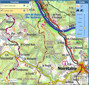
To find this peak, I went with the summit coordinates provided on the SOTA site and looked on GoogleMaps for the nearest road. The road I found runs to the east of the peak and is unnamed.
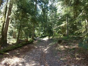
It was a relatively short ride from Les Cornes d’Urfé, but I should mention that the access road is mostly dirt and narrow in some places. It winds through a logging area, through a dense pine forest. Every now and then, there are large piles of pine trunks. As I drove down the road kicking up dust, I got to the point due east of the summit and then went a bit more without seeing any trails towards the summit. However, when I backtacked about 200m from the position to the east of the summit, I saw where the road branched upward.

The path to the top
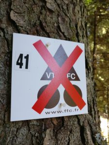
Even the bottom of that branch road was too rough for my rental car, so I parked it off to one side and trotted up the side road. I did not see any sort of name on the side road, but I came across this marking, which I interpret as a message from the french cycling federation to mean that cyclists should not attempt this road. This is good advice, because aside from a steep slope at points and loose rocks, there are a few places where entire tree trunks have fallen across the road.
The road continues to climb in a direction leading to the east of the summit, at times resembling a road, but at other times, just melting into a forest path that does not appear all that worn. When my GPS indicated that I was about east of the summit, I saw a more narrow, furrowed path taking off in the right direction.
Following that path, I came to a place where paths intersected from the cardinal directions, presumably along a ridge. So, there must be other ways of reaching this peak, although they do not seem to be marked on the topo maps of the area that I was able to find.
On the air
Again, there were plenty of tall pine trees, and the end-fed antenna was up in no time. I found a comfortable log to sit on and worked 18 QSOs on 40m, and another 5 on 20m, roughtly the same proportion as earlier in the day from Les Cornes d’Urfé. Again, I had a summit-to-summit contact with CT7/HB9BIN/P on 20m.
Pot-belly Pete
As I was walking back down to the car, I wondered what the summit was named after. At first, I thought “Pierre” might have be a reference to a rock of some sort, it being a peak, but the more I thought about it, the more convinced I became that it’s a name: Pierre as in the french equivalent of Peter. As for Beille, I know there is a Plateau de Beille near the eastern Pyrenees, but that is a different area. I found one reference that it suggested it as a nickname for a portly man (I wonder if it has some relation to the English word “belly”). So, while I might be entirely off base with this assumption, I now think of this summit as “Pot-belly Pete Peak”.
Next stop: Le Pic Pelé.


One thought on “SOTA: Pierre Beille (F/MC-240)”