

This two-point peak does make you work for those two points. It is located a bit north of Limasol or about an hour’s drive from Nicosia. GPS will get you pretty close along route F130 to a dirt road turn off. That dirt road runs around the mountain and climbs gradually along the way. When you have gone about halfway around the mountain, there are a couple of cut outs where you can pull over to the left but still leave enough room on the road for other vehicles to pass you on the outside of the curve.

Up to that point, the slope upward to the left has been steep, but it becomes progressively flatter and more like a meadow than a wall of stone near the parking areas. There is, however, no real path up. After walking back and forth along the road looking for the best place to begin the ascent, I just picked a spot where there was some room to walk between the vegetation.

From time to time, I came across what might have been a path at one time or perhaps was just where water runs off after rains. Long ago, this hill was probably terraced and there are remnants of walls at some places. Where these have fallen, you can scamper over the rocks or sometimes walk along intact walls.

Looking at the topographic map, the least steep way up follows the spine of the hill. The path I took tended to the south side of that spine. When you crest the first hill, you can follow the wall above for some distance. At this point, there is little grade and the top of the hill is grassy and rocky.

From here, you can see to the summit, which rises the last 50 meters or so. Again, there is not much in the way of a trail — my advice is to just do what you can to walk between the plants. I found it very helpful to have two walking poles on this trip, both for assuring good footing and for pushing aside all the plants with spiky leaves. Thick pants are also recommended because the very fine needles of the various undergrowth will do their best to scratch you up.
Once up the final hill, there is a great view in all directions. The are some marginally tall trees below the top, but none of them rise above the peak, so I would not recommend them. At the summit, there some bushes but no tall trees.

A pole of some sort really is needed to get the antenna in the air up there, and your choices are to either lash it to a small bush or to try to guy it down as I did. I made a small pile of rocks and stuck my SOTAbeams fiberglass pole in the middle and guyed it as best I could.
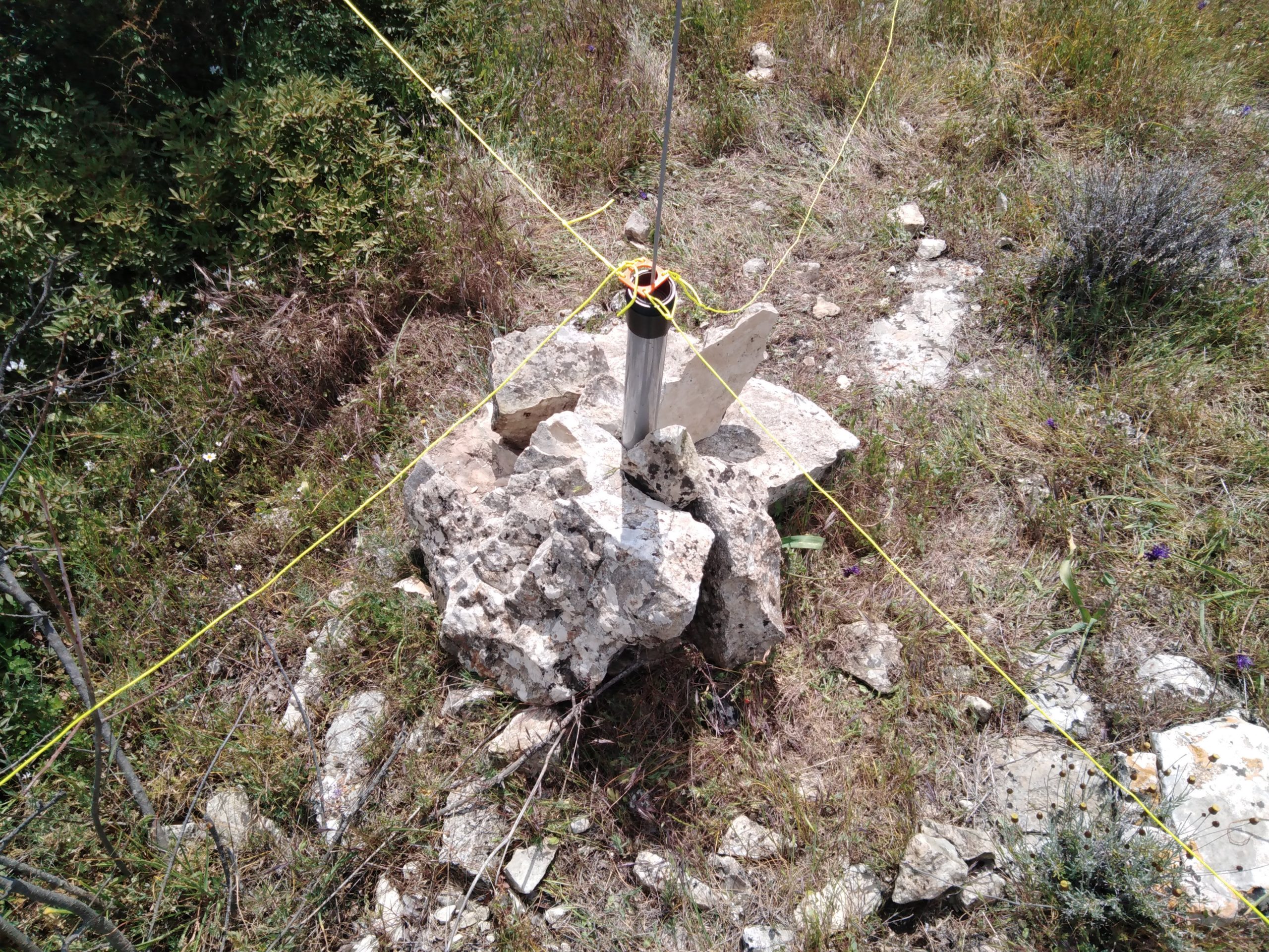
I would have liked to guy the pole higher up, but I only seemed to have the lower guy ring with me. Although it was intermittently windy at the top, this seemed to work well enough. I was able to push some stakes into the ground here and there or tie them off to bushes.

There is a rather sad looking trig point at the top of the hill. Unfortunately, the information plaque around the trig point was broken into pieces — I leave it as an exercise for the student to try to decipher these tablets.

From a practical standpoint, or sitpoint I suppose, I found it uncomfortable to sit on the trig point itself, whereas the large flat slab fragment next to it was very comfortable as a seat. I draped the end of my end-fed antenna over a bush next to this position and operated 20m CW until the replies dried up. Of note, I had good cell reception from this location and low background noise on HF.
A couple random observations from up there. There is a good view to the south towards Limassol and just to the west of the city, between the mountains, you can see the flotilla of cruise ships that have anchored off the coast to wait out the pandemic.


I found one other item interesting: right next to my antenna site there is a stone-work depression. I suspect it is an ancient structure of some sort, perhaps a small room or the bottom of an earthen oven or kiln? Next time, in addition to a radio and feedline, I need to remember to bring an archeologist with me.
